
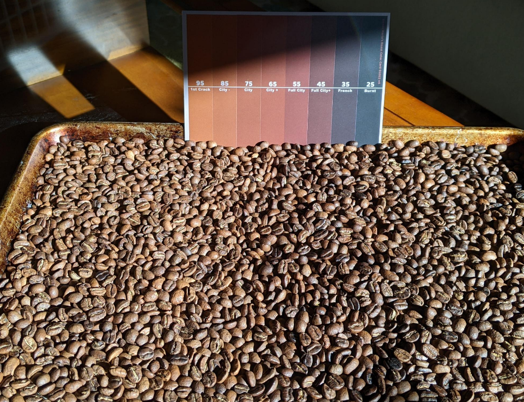
I got a roast level color card from #sweetmarias as a gift so I used it to compare two roasts. Squint your eyes and try to decide! I think weight change pre-post roasting might be the better method 😅
Sharing my new project here, hilly: https://gitlab.com/ryanmcginger/hilly
I wanted way to summarize GPX traces from ski and mountain-biking trips. Loads data to GeoDataFrames, filter out lift rides, view with leaflet as raw points or rasterized density!
#python #geo #outdoors
In addition to supporting artists, the song on this page is my favorite part of Bandcamp Friday
https://isitbandcampfriday.com/
Having fun with some #3DEP #lidar #pyvista and some GPS traces from a hike near Boreas Pass, CO.
https://ryanmcginger.gitlab.io/lidarmaps/boreas-pass.html (80MB, takes a min to load)
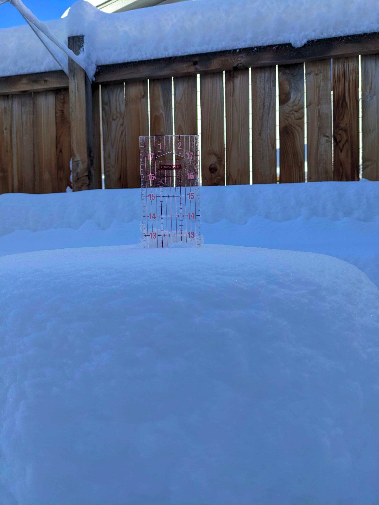
Ice pellets (tiny ice spheres) that fell last night before the snow. The sound of these hitting the windows was bizarre. #icepellets #cowx
A good day to read Letter from Birmingham Jail. https://letterfromjail.com/
#MLKDay
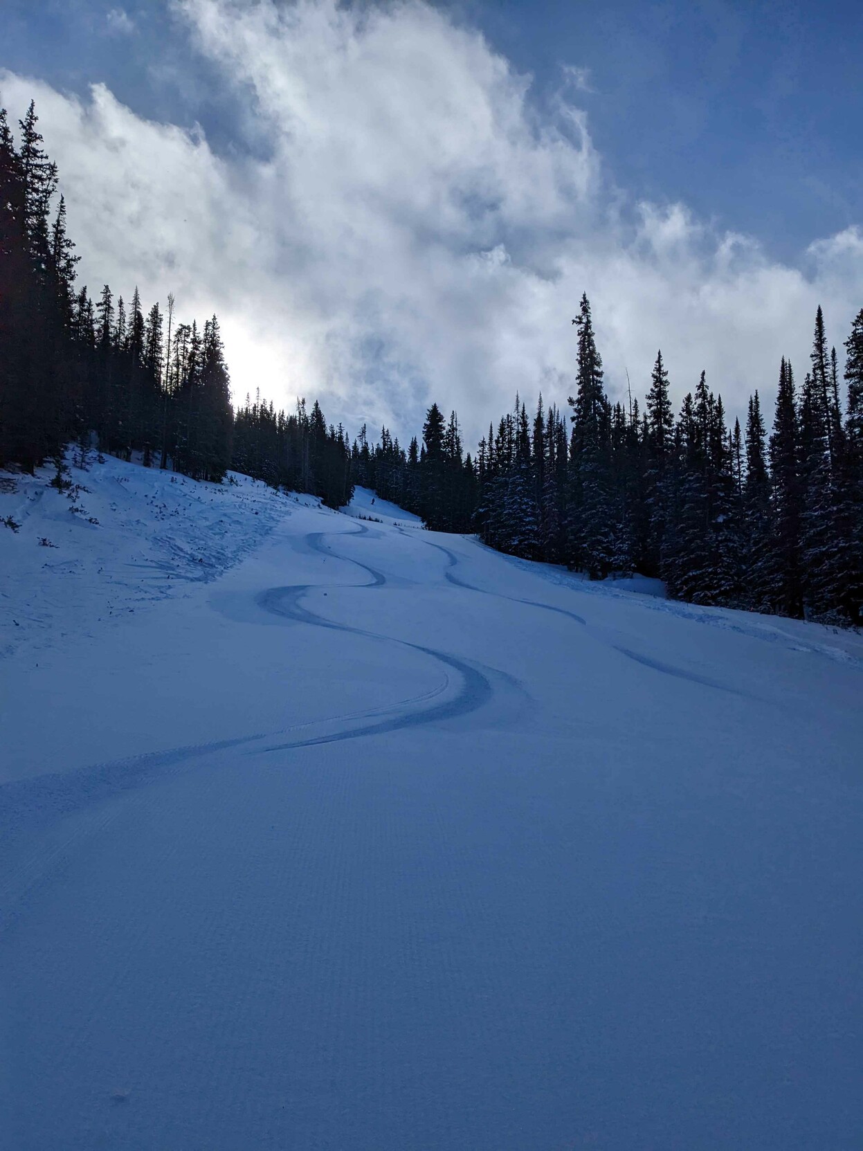
Great day at #loveland! We got first tracks on a run after getting in early. #firstchair #skiing #snowboarding
The OSMF Board has released a statement on Overture Maps. We welcome the community’s feedback, questions and discussions.
Views from the OpenStreetMap Foundation on the launch of Overture https://blog.openstreetmap.org/2022/12/22/views-from-the-openstreetmap-foundation-on-the-launch-of-overture/
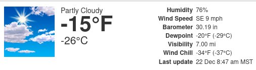
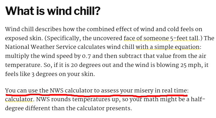
I appreciate The Colorado Sun's honesty when describing wind-chill:
https://coloradosun.com/2022/12/20/cold-front-coming-common-questions/

Jan. 6 panel recommends 4 criminal charges against Trump for ‘attempted coup’
@RepDianaDeGette: "Trump incited a deadly insurrection to overturn the election. He must be held accountable."
ow.ly/AJ6X50M7ESx
Toot! New instance up and running!